As spring days get longer, it is time to think about those bigger ski tours on your list. Of course with the warm spring weather, approach and access need to be considered. I like to think about lines that have good trail, creek, or open avalanche path access that can provide expedited travel to the alpine as they freeze better than densely treed areas. While Mt. Lyautey starts off with a long valley bottom approach, an open avalanche path provides access to the glacier, and there is the potential that the trail could be melted out, while the line has wintery snow up above. I first noticed Lyautey glacier in some summer skiing pictures and was intrigued with the spot. A week before this trip, while attempting Mt. Joffre, I was in awe of the couloir riddled SE face of Mt. Lyautey.
 |
| Approach |
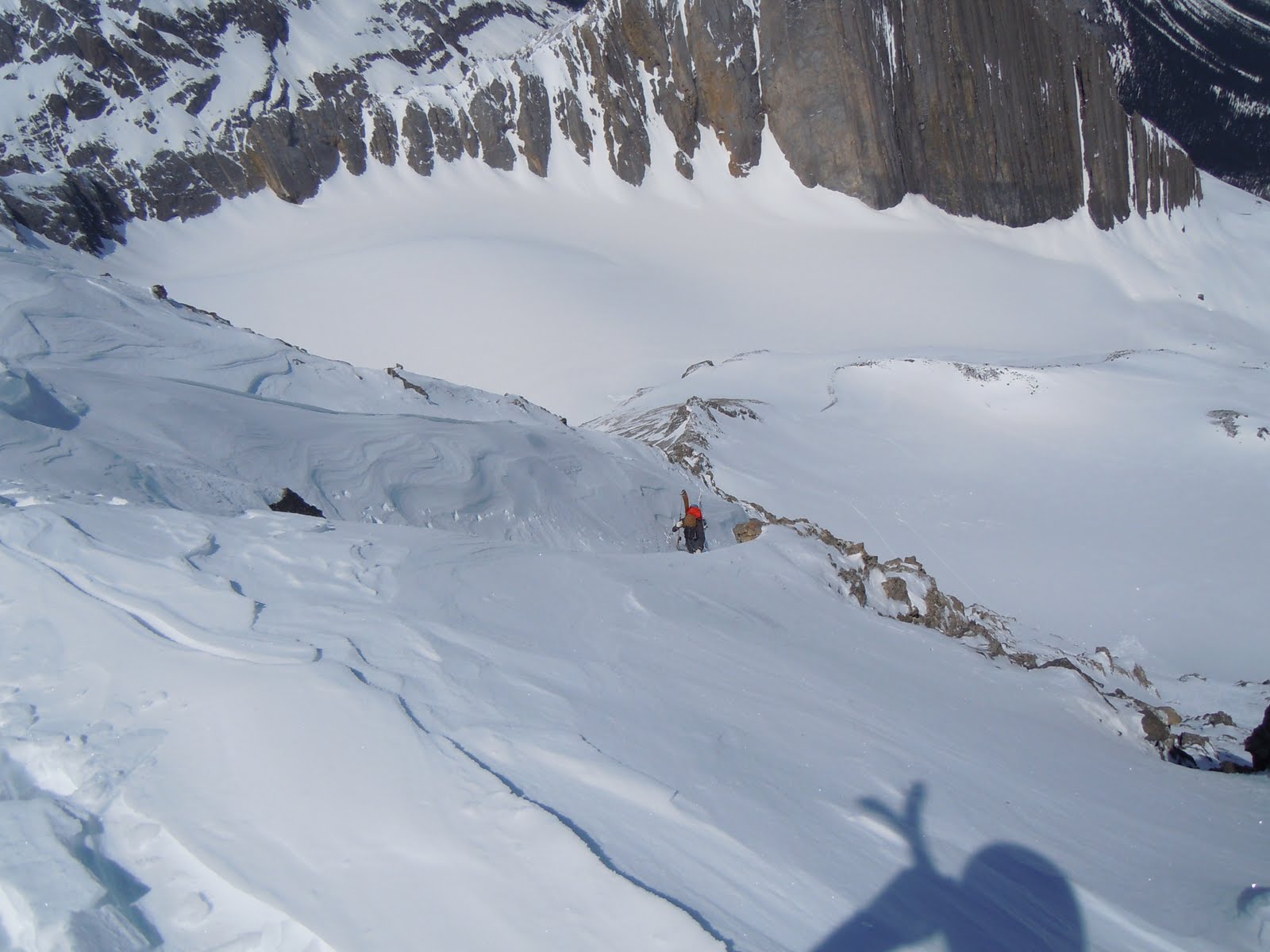
Start the day off with a 6.5km slog from North Interlakes Day Use, almost to the Forks campground. The map link might come in handy for determining where to leave the trail as there are a couple of avalanche paths and drainages that converge in a similar area. Once in the creek, we ascended the drainage to the moraine on the climber's left side. I believe there is a small waterfall that can get buried with snow under the climber's right side. Once on the moraine, it is an easy ski onto the glacier where a north face that is absolutely riddled with couloirs stands out.
 |
| Looking up the glacier. Summit is the high point on the right side |
On the climber's left side of the face are two prominent couloirs and we even made an attempt before discovering windslab. They however, do not lead to the summit! The summit is accessed via a much less "walled-in" couloir further on climber's right.
 |
| The line to the summit with tracks down it. Obviously endless possibilities for ski descents! |
 |
| Looking down the line from the top. Both glaciers are visible at the bottom. |
On the exit, we skied down the skier's left side of the moraine (not the side we climbed up)
Round Trip Distance: 21km
Elevation gain: 1550m
Top elevation: 3045m
Line length: 200m
Other options in the area: Once you are committed to the drainage, there are options for more mellow skiing on either of the glaciers and the col to the west of Mt. Lyautey. There are many skiable lines on the North face of Mt. Lyautey. If you do not wish to commit to the creek heading up the moraine, you could ski even deeper up the valley to 3 Isle lake and attempt to ski north facing bowls on Defender Mountain, Mt. McHarg, and Mt. Worthington.
 |
| The equally "delicious" SE face of Lyautey |
As you can camp at the Forks campground, the Lyautey glacier can also make an excellent summer skiing objective.
Hillmap route
Other
Lines of the Week .
Other
Kananaskis lines.


No comments:
Post a Comment